Walking the Weber in Oakley This Winter: Which Stretches of the River Trail Connect Now?
November 12, 2026
November 12, 2026
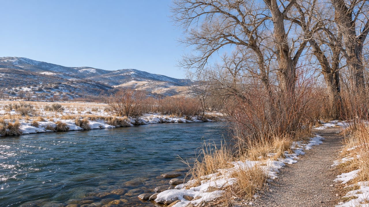
When someone in Oakley says they walked the river trail this morning, where did they start? Millrace Road, the end of Franson Lane, Pinion Lane or Woodenshoe Lane are all possible answers. That's because the Weber River Pathway isn't a single trail yet. It's a set of pieces that Oakley City, Summit Land Conservancy, South Summit Trails Foundation and Summit County have been joining one easement and one parcel at a time.
That patchwork matters more in November than in July. Each piece has its own manager, so each one also has its own winter conditions. At Marchant Meadows, horses and bikes are shut out whenever cattle are grazing. The newest connector turns soft after snow, and across from Franson Park sits ten acres of protected riverbank with no trail on it yet. If you know which piece you're standing on, you'll pick the right walk.
The trail distances below come from South Summit Trails Foundation's trail maps, and the acreages come from the conservancy and county. All of them are approximate, and conditions change with the season.
| Piece | Where you start | Rough size | Who's behind it | Winter catch |
|---|---|---|---|---|
| Stevens Grove Trail | Trailhead parking off Millrace Road | About 1.5 miles out and back | South Summit Trails | Dogs on leash; now continues to Marchant Meadows |
| Feb. 2026 Weber River Pathway link | Stevens Grove Trail to Woodenshoe Lane | Not published | South Summit Trails, Oakley City, Summit Land Conservancy | Wait for a dry surface after snow or wet weather |
| Marchant Meadows Preserve | Parking lot off Wooden Shoe Lane, Peoa | 86-acre preserve | Summit Land Conservancy | Foot traffic only when cattle are present |
| Franson Lane loop | End of Franson Lane, beside the cul-de-sac | About 0.7-mile loop plus short spurs | South Summit Trails | Dogs leashed, waste packed out |
| Four Badgers | Across the river from Franson Park | 9.82 acres, no trails yet | Summit County, via Summit Land Conservancy | Not a walk yet |
| Oakley Trail Park | Oakley Trailhead parking, Pinion Lane | About 81 acres under easement | Oakley City, conservation easement | Year-round hiking, biking and horses |
The biggest change this year is on the second row, the link between Millrace Road and Woodenshoe Lane.
For years, Stevens Grove was a short out-and-back of about a mile and a half. You walked the cottonwoods along Millrace Road, turned around and came back. That changed in February. TownLift reported that South Summit Trails had finished a new segment linking Stevens Grove Trail to Marchant Meadows Park on Woodenshoe Lane. That gave Oakley a continuous non-motorized route between residential streets and the river meadows downstream.
The new stretch is open to hiking, running and horseback riding. It came with one request from the trail builders that applies directly to this time of year. The soils next to the river stay wet, so trail users are asked to wait until the surface dries out before heading out, which keeps the new tread from getting damaged. In winter, that means the day after a storm is the wrong day for this piece. A cold, dry morning after a stretch without snow is the right one.
South Summit Trails credited Oakley City, Summit Land Conservancy, Doug Evans of the South Summit Trails Foundation, grant partners, donors and volunteers for the work. Additional segments are planned in future phases.
At the downstream end of that link, the trail meets land that is still a working ranch. Summit Land Conservancy's Marchant Meadows Preserve covers 86 acres along two branches of the Weber in Peoa. The Marchant family held it for six generations, when it was known locally as Three Rivers Ranch. The conservancy acquired it in 2020 as its first publicly accessible preserve.
That history affects whether you can get in. On the preserve's own page, the conservancy says trail status depends on weather and on the active grazing schedule. When cattle are on the property, gates must stay closed and only foot traffic is allowed. Spring flooding can also limit use. So a ride you took in October may be a walk-only outing on a given day this winter. The conservancy posts current notices at the top of its Marchant Meadows page, and it asks visitors to call its office if they see cattle on the trails.
Riders now have a dedicated way in. The conservancy finished equestrian access on the far side of the river from the parking lot. Horses go through the horse access gates from the lot to cross the river, and there's a spot to hitch up and saddle before riding. Dogs have to stay on leash, and motorized vehicles aren't allowed.
Winter is a good time to look up here. The cottonwood groves hold a longstanding great blue heron rookery, which is easiest to see once the leaves are down. The USDA's Natural Resources Conservation Service lists the property as habitat for elk and eagles.
When South Summit Trails announced the February connection, it also mentioned that bald eagles had recently been seen on the new trail system. That fits the statewide pattern. According to the Utah Division of Wildlife Resources guidance reported by Gephardt Daily, bald eagles winter in Utah, and February is typically the best month to see them. DWR's named Weber River viewing spots are farther downstream, near Croydon and below Echo Reservoir.
DWR's etiquette applies whether you're on the pathway or on a county road with a river view:
Since most of this corridor runs past private ranch land, the first point matters a lot here. The public pieces are narrow strips along the bank.
The Franson Lane trail starts where the road ends. Public access and parking are at the end of Franson Lane, and the entrance is beside the cul-de-sac. The Franson Lane trail map shows a loop of about 0.7 miles, a short river-access spur and a 0.13-mile Meadow Walk. All dogs must be leashed, and waste has to be packed out.
Across the water is the corridor's newest addition. In late August, the Summit County Council approved a deal KPCW described as $1.6 million for the Four Badgers property, 9.82 acres made up of 10 parcels split among three landowners. KPCW reported that Summit Land Conservancy would buy the land and then transfer it to the county. The reported funding sources are $831,000 from the county's 2021 voter-approved open space bond, $800,000 from a Utah Outdoor Recreation Infrastructure grant and $49,000 from the conservancy, which will also manage the conservation easements.
The state grant alone covers roughly half the cost.
County Councilmember Tonja Hanson described the parcel's role on KPCW's "Local News Hour." "This is located, for folks who are familiar with that area, across the river from Franson Park," she said. "It is a strategic part of the larger Weber River Corridor project. Right now there aren't trails on this parcel, but there is connectivity, and there will be trails that connect to other recreation areas there in Oakley."
Development won't be allowed on the land. One property has a cabin that the conservancy has agreed to maintain for at least five years. For now, the best way to see Four Badgers is from the Franson side.
If the river pieces are wet, gated or not built yet, Oakley Trail Park is the reliable option. It sits along Pinion Lane in the foothills. Last December, Summit Land Conservancy and Oakley City announced a permanent conservation easement covering about 81 acres of open space, watershed, wildlife habitat and public recreation access there, according to TownLift's report. The park is described as open year-round for hiking, biking and equestrian use. The South Summit Trails map marks an Oakley Trailhead with parking.
On a winter day when the riverbank is too soft to walk, it's the Oakley trail system with permanent protection and year-round use already in place.
The long-range goal is much bigger than what exists today. Summit Land Conservancy has worked with Oakley City and willing landowners since 2016 to put trail and land easements along the river. A 2024 TownLift report described the Oakley River Corridor Project as running from the base of the Uintas to Peoa, with seven miles of soft-surface trail planned between Oakley and Peoa.
So far, Stevens Grove connects through to Marchant Meadows, Franson Lane is a standalone loop, Four Badgers is protected but has no trails, and Oakley Trail Park sits up on Pinion Lane on its own. What's still missing is the stretch between them.
I'm Cameron, and if you'd like to talk about which pieces of this corridor sit near a property you're considering, or how a parcel like Four Badgers could affect access along the river, Cameron Boone knows these trailheads and the valley around them. Let's Connect.
Stay up to date on the latest real estate trends.
As a young real estate agent, I bring a unique blend of youthful energy and extensive hands-on experience, having successfully completed over 150 transactions totaling more than $85 million in sales. My roots in Park City run deep – I own my primary residence in the charming Old Town neighborhood and have also invested in two additional rental properties in the same area.